Home » All Blogs » Modeling Arctic Waters
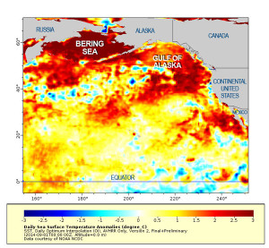
Water is strangely warm in parts of the North Pacific: in the Gulf of Alaska, off Southern California, and stretching across the Bering Sea. A NOAA Northwest Fisheries Science Center press release reported: Not since records began has the region of the North Pacific Ocean been so warm for so long. That references over a […]
Instruments made to measure currents tug against their moorings on the sea floor. Others bob and whirl, catching currents, winds and tides with their rectangular wings spread just under wavetops in the Bering Strait west of Alaska. Ocean water is on the move. “There’s a strong connection between the world’s ocean currents and what comes […]
A new data set shows central Arctic Ocean sea ice thinned 65% between between 1975 and 2012. The study, authored by University of Washington Applied Physics Laboratory scientists, combined observations gathered through many means and incorporated them into a consistent format. Data came from sources including submarine-born sonar, airborne measurements, satellite imagery, and instruments moored […]
Azara Mohammadi for Frontier Scientists – In 1996, Dr. Kate Hedstrom travelled to Norway to “Sit on Paul Budgell’s steps,” as she says. She went there to get a piece of code recently improved by Paul Budgell. “He promised his model and I went to Norway to get it!” says Kate. Hedstrom is an Oceanographic […]
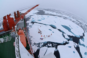
Laura Nielsen for Frontier Scientists – Polar waters are unpredictable. The Antarctic rescue operation currently underway illustrates that fact thoroughly; the United States Coast Guard icebreaker Polar Star is en route to rescue the Russian research ship Akademik Shokalskiy and the Chinese icebreaker Xue Long which earlier came to the aid of the beleaguered Russian […]
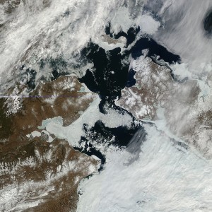
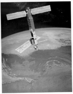
A time capsule of satellite imagery of the earth will become available to scientists this month. On June 28, digital imagery from more than three decades ago will be released by the Alaska Satellite Facility at the University of Alaska Fairbanks Geophysical Institute, NASA’s processor and distributor for this type of data. The images reveal […]
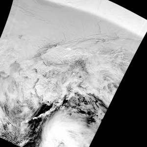
Liz O’Connell for Frontier Scientists – During winter in the Arctic it’s “night” almost all the time, but thanks to the new Visible Infrared Imaging Radiometer Suite (VIIRS) Day/Night Band (DNB) we no longer have to be in the dark about what’s going on with the weather. Here is a VIIRS/DNB image of the Alaska […]
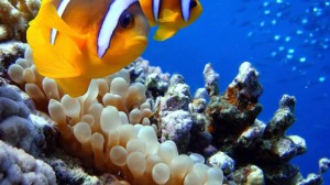
Laura Nielsen for Frontier Scientists Will ocean acidification spell a watery grave for vital parts of marine ecosystems? Marine ecologist Jane Lubchenco, head of the National Oceanic and Atmospheric Administration, named ocean acidification global warming’s “equally evil twin.” * Burning fossil fuels — coal, oil, natural gas — cutting down forests and other post-industrial […]
Liz O’Connell for Frontier Scientists – Fairbanks, Alaska, September 4, 2012 – Three videos introduce the oceanographic modeling work from the University of Alaska Fairbanks (UAF). The video Modeling Ice in the Arctic, shows a regional ice model coupled with a global climate model. “The ice is not as stiff as it used to be,” said Kate […]
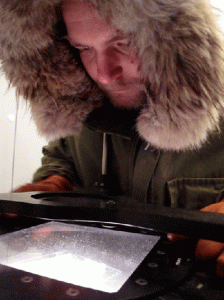
Ned Rozell for UAFGI – Marc Mueller-Stoffels unscrews the top of a glass jar and invites a visitor to smell the powder inside. A sniff evokes the image of kayaking Prince William Sound or walking a beach in Southeast. “We call it ‘Instant Ocean,’” he says, returning the lid to the jar. Mueller-Stoffels, a doctoral […]