By Carin Ashjian for The Arctic Winter Cruise 2011
We are heading south towards Bering Strait and the Bering Sea beyond. As we go, we are moving through young ice, with smallish pancakes ahead of the ship. The ice lamps illuminate the pancakes. The ship rumbles as she plows through the loose pancakes, with a constant crunching. This ice is relatively thin. Gone is the screeching as the ship pushed through thick, hard ice. Gone is the backing and ramming as we try to get through an especially hard ridge. Now we are going to face the Bering Sea, the sea of “Deadliest Catch” lore. One huge, low pressure system after another has been rolling through the Bering for the last month. We cannot hope to escape completely. Working will be hard, much harder, there.
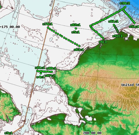
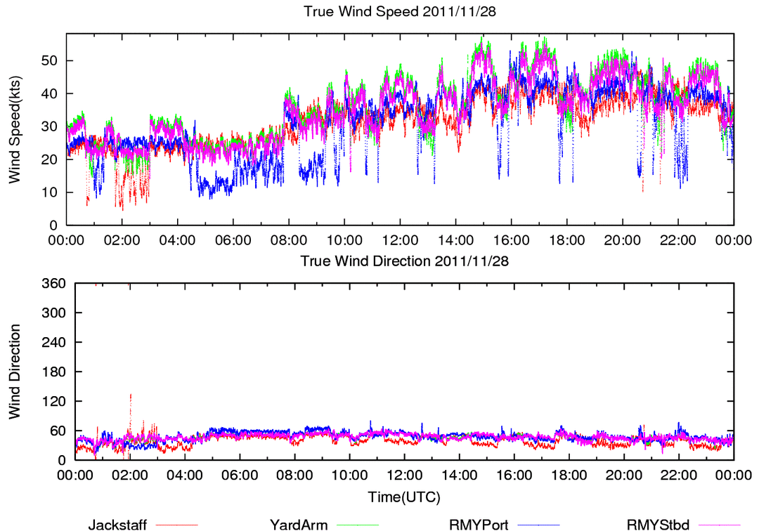
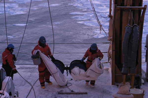
We had a little taste of the conditions to come today as we worked across at transect that was placed near Point Lay, AK (southernmost transect on map). Winds reached 40-50 knots. There was loose ice on the surface of the ocean. As we deployed gear, we had to take care to not catch the wires on the pieces of ice floating, or rather flying, past. We had to pull the CTD back in on one cast without sampling because the ice was too crazy, swirling and rushing past the ship. The wind was blowing at least 40 then, straight at the deck where we were deploying the CTD. Streams of water were coming off the surface of the ocean. Just walking was difficult, never mind using the ice pole in a futile effort to stave off the ice floes. We repositioned the ship in an area with a bit less ice, and re-deployed the CTD for a successful cast.
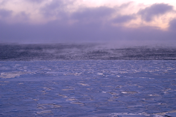
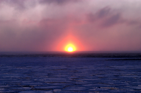
Now our work in the Chukchi is done and we move on to sample the Bering Sea. The sun rose today, treating us to a brilliant display over the newly forming ice. In many places, we see pancake ice adjacent to open areas where “sea smoke” is rising, water evaporating from the surface of the ocean.
Our next plan is to sample across the eastern side of Bering Strait. The US-Russian border runs down the middle of Bering Strait, right between two islands: Little Diomede on the eastern/US side and Big Diomede on the western/Russian side. We cannot cross over the border to the Russian side to sample so we will be working only on the eastern side of this important “gateway” to the Arctic Ocean. Our ice analyst says that there is ice even to the south of the Strait so we are looking forward to another couple of days of sea ice before we face the open ocean, and waves and swell, of the Bering Sea.
By Carin Ashjian for The Arctic Winter Cruise 2011, WHOIExpeditions http://arctic-winter-cruise.blogspot.com/2011/11/into-jaws-of-bering-sea.html Tuesday November 29th, 2011
Read the Cruise Overview.
Go to the article list on the FS project page.
See WHOI’s audio slideshow highlighting the cruise.
