It’s just a matter of time before one of the volcanoes in the chain that lines Cook Inlet erupts. But time in geologic terms is a bit like the federal deficit; so vast in scope it’s hard to comprehend.
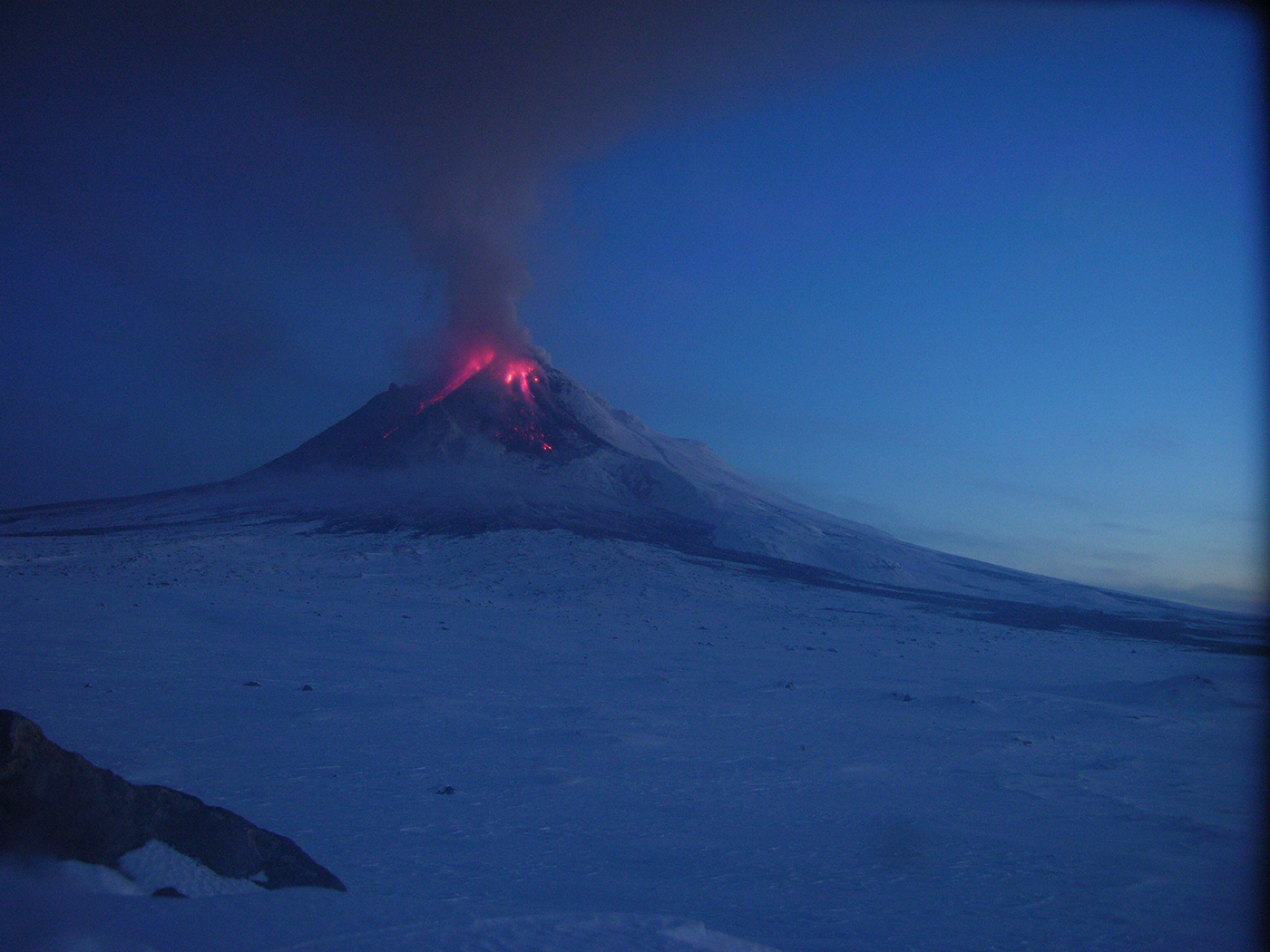
The Cook Inlet volcanoes of south central Alaska are practically babies when it comes to earth rock. “If you’re studying Precambrian geology, 10 million-year-old rock is young,” U.S. Geological Survey research geologist Michelle Coombs notes. “Most of the volcanoes I’m researching started 500,000 years ago or less. Mount Spurr for example came to life 300,000 years ago or less, and it’s been very active over the past 5,000. It’s all relative.”
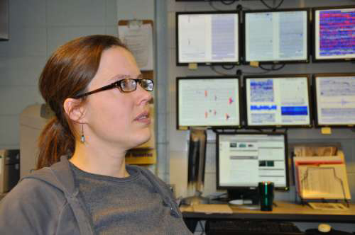
These babies are looked after by scientists at the Alaska Volcano Observatory (AVO), where Coombs works recording and analyzing every burp from every fumarole. Coombs’ current field of study is focused on the Aleutian arc, a geologic sickle of active and dormant volcanoes extending along the Alaska Peninsula through the Aleutian Islands. It puts her in the thick of some of the planet’s most restless rock, with recent eruptions on Redoubt (2009) and Augustine (2006) in addition to Spurr (1992).
With one situated within 80 miles of Anchorage, these volcanoes are the closest to the population centers of southeast Alaska, making monitoring an important hazard management task.
This tracking involves an Ops Room, dozens of ground measuring instruments, audio sensors, GPS technology and even orbiting satellites.
Coombs explains: “We make use of multiple satellites, from NASA and commercial to NOAA’s weather satellites. They provide us different data as needed, some with routine fly-over shots a few times a day, and others with specialized high-resolution photos.
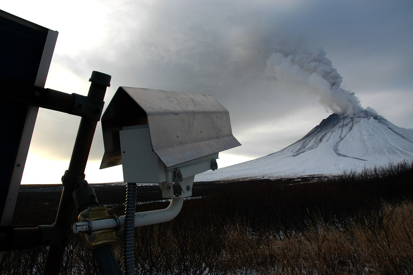
“We also use stationary, continuous GPS monitors, which are like scientist-grade Garmin pocket units, with bigger antennae that can detect bulges and deflations of the cones within millimeters and through time. It’s pretty typical to have five seismometers situated at different distances from a volcano to monitor seismic activity. We often pair these sensors with webcams that record and send images every hour or so.”
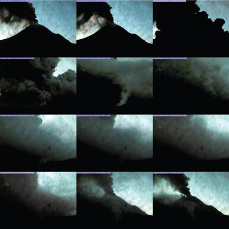
One set of these instruments recorded the following time-lapse images of a Mount Augustine 2006 blast. Over the space of about half an hour on January 13, 2006, an ash cloud looms, envelops the webcam, then clears.
When the next explosion comes, arrays of infrasound sensors—one stationed in Fairbanks hundreds of miles away—will detect potential pyroclastic wave activity in the air. Says Coombs, “We did try ocean bottom seismometers, but the data were really noisy due to the very strong currents in Cook Inlet.”
The data flow at the AVO in Anchorage where Coombs works is two-way during eruptions, as the public tunes in to webcam feeds and updates. During the Redoubt volcano eruption of 2009, web site visits shot up from 8.7 million web site visits (December 2008) to 75.4 million in March ‘09. Page views spiked from 3.4 million to 28.1 million for the same months, with the peak day March 23, with 2.7 million page views.
Geological research is not all high tech. Since her primary work is to gain understanding of a cone’s entire eruptive history—how often it’s been active, variations in magnitude of eruptions—Coombs says good, old-fashioned tools such as hammers and shovels are just as essential. “In the field we’re dealing with hard rock flows, so you need a rock hammer to get to a fresh surface. We’re sometimes looking at a layer cake of ash fall, so I use a gardening trowel for smoothing the surface to look at the strata, and a hand magnifying glass to examine what minerals are in the ash.”
Coombs says Alaska can be a challenging place to work for researchers. “There’s the weather to contend with, and dealing with bears, and many places are very remote and expensive to get to. Ash is dusty and dirty, and when you’re in the field the only bathing you typically get is a ‘sun shower.'”
But this Frontier Scientist also loves the rewards. “We’ve got earthquakes, active volcanism – it’s a great place to study active geology.”
Merry Ann Moore 2011
Frontier Scientists: presenting scientific discovery in the Arctic and beyond
Cook Inlet Volcanoes project